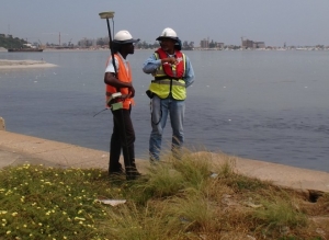
DRAIMAR performs hydrographic and topographic surveys using a range of GPS and DGPS survey systems, as well as traditional total stations, theodolites and levels. Using Trimble and SOKKIA equipment and HydroPro, NavEdit, Terramodel and AutoCAD programmes the surveyors support all the main divisions of DRAIMAR with project planning and execution.
Within this division is a section concerned with measuring currents either on the sea bed or at varying depths within the ocean and in tidal areas. The meters are positioned throughout monthly tidal cycles and are retrieved using a sonically activated buoy retrieval system.
The department also performs side scan sonar surveys, magnetometer surveys and geo-physical investigation using strata boxes to make detailed surveys of the sea bed.
The surveyors and equipment are available for hire on a project-by-project basis.
